Wicksteed Lake and Mackenzie Lake
Day One, September 12th
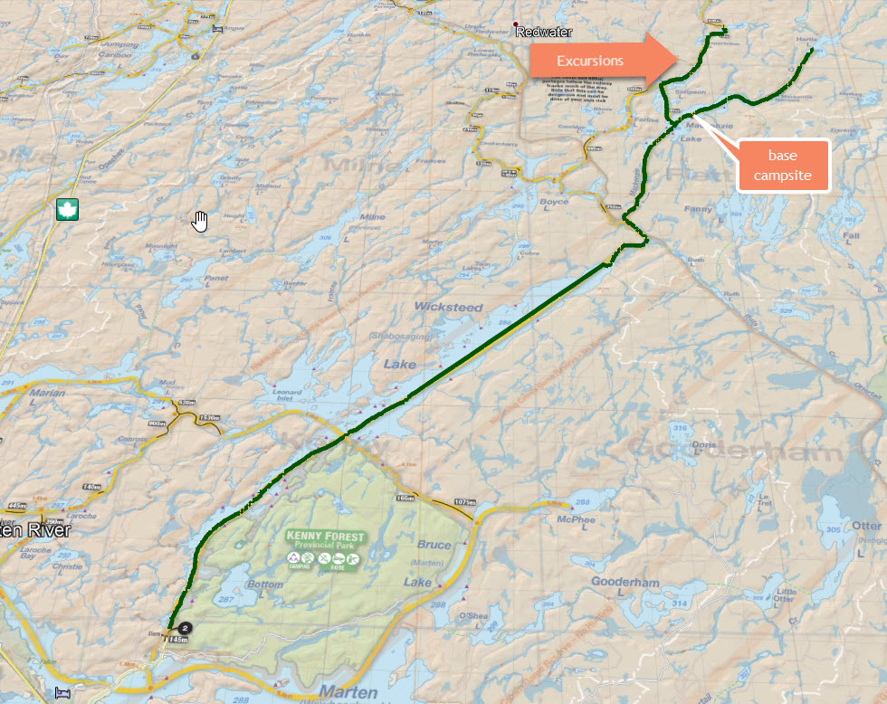
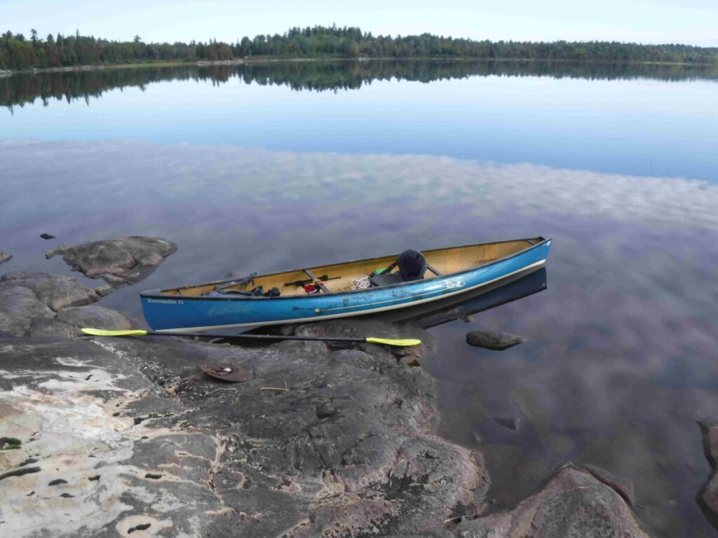
It’s 12:30 pm. I pull into the Swift Canoe and Kayak store in South River, Ontario where I will pick up a 15 foot solo pack canoe. This trip I am renting a Keewaydin Pack 15 instead of the shorter and slightly lighter Adirondack Pack 13.6 I’ve used before. I hear that the lake I ‘ll be canoeing can get rough and I want my canoe pack to settle down into the canoe to avoid windage, hence the slightly larger canoe choice. I am heading for the put in at Wicksteed Lake, past North Bay on Highway 11, planning to paddle Wicksteed to its eastern end and then take Mackenzie Creek to Mackenzie Lake, staying there three nights and exploring creeks that run out of the lake.
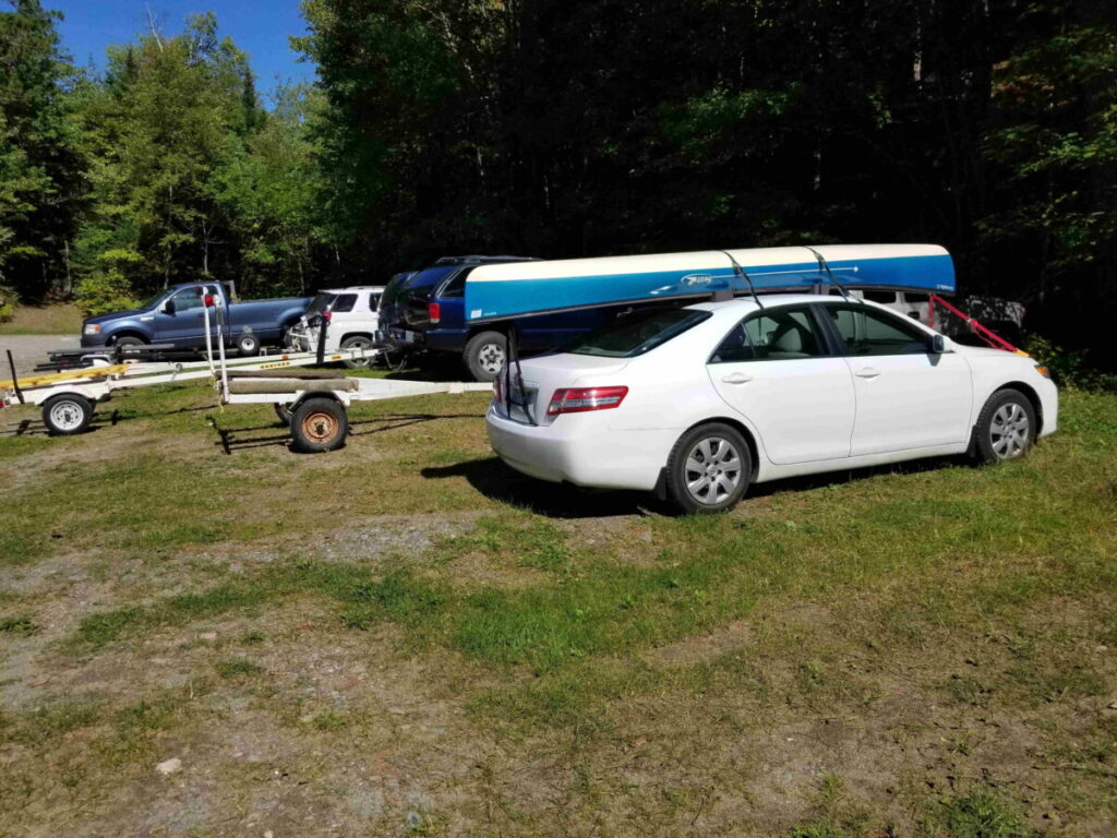
Forty five minutes later, the canoe is secured to the top of my car, and after a short stop at the next door liquor store to get a mickey of dark rum for chilly evening sips, I’m on my way again. After one hundred and twenty kilometers and an hour and a half I arrive at the access point at the end of a narrow road through the forest, which at first I miss, driving past its unmarked entrance on the main Marten River Road. I see that it’s popular for fishing, by the pickup trucks with empty boat trailers parked near the water.
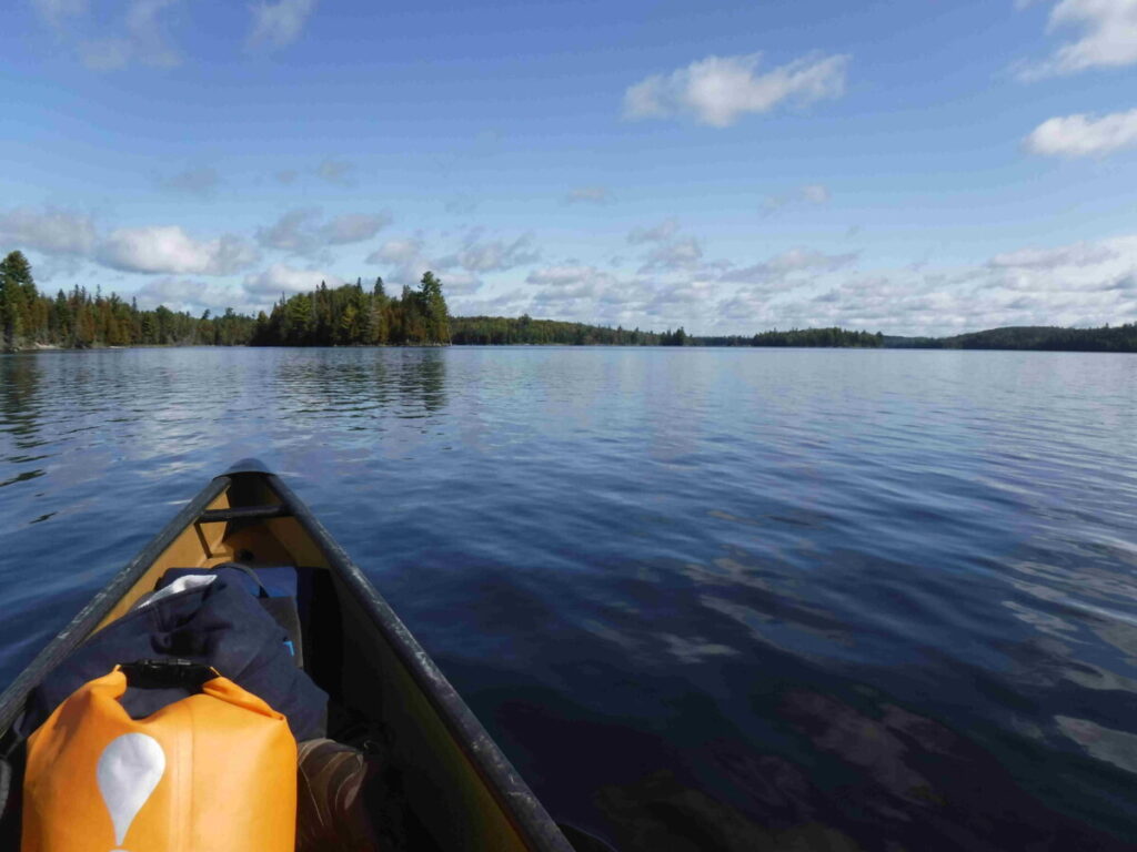
By 3:00 pm I am on the water paddling against a light breeze under a mostly cloudy sky. I am later than I planned and will not get as far up Wicksteed Lake today as I had hoped.
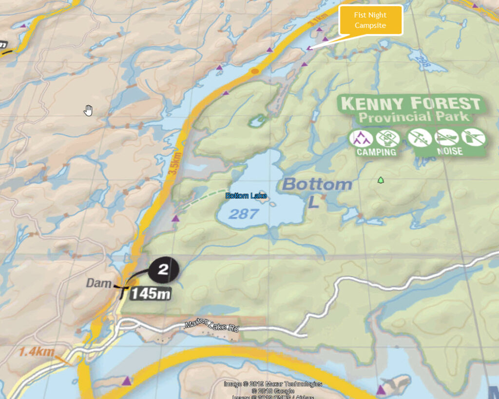
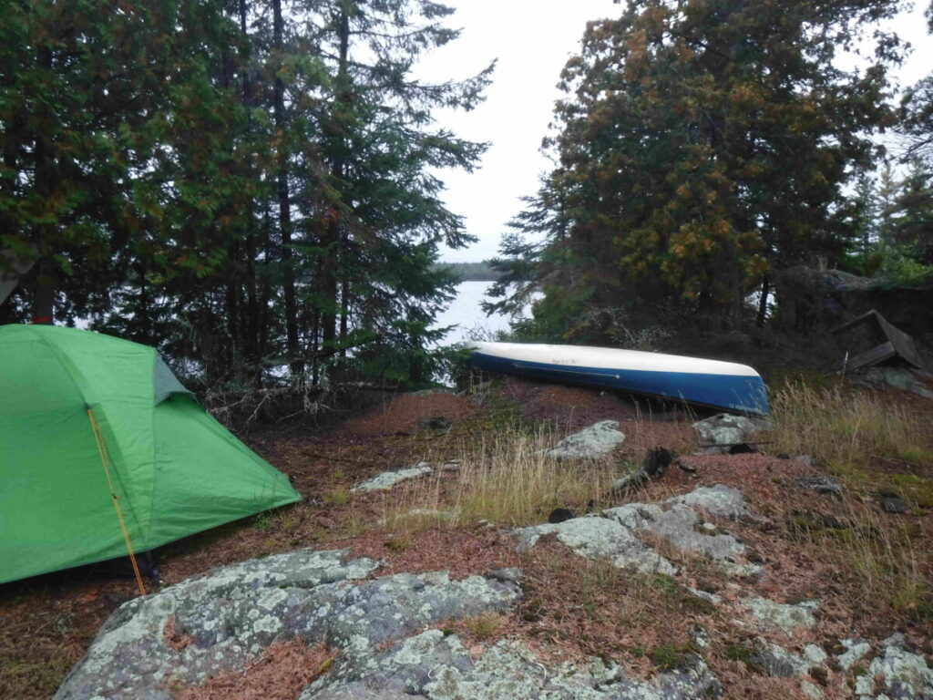
The campsite I pick is on a small island that rises steeply from the water on all sides with a good protected landing spot for the canoe. Maybe I should paddle on further, but decide I’ve had enough for today with the long drive to get to the lake from Toronto. I’m looking forward to relaxing.
This campsite is obviously well used by people fishing, board tables put up between trees with telltale fish scales , a couple of collapsible camp chairs piled off to the side of the main site, three (why three?) roughly made thunder boxes. I have mixed feelings about the extent of human modifications, convenient but more intrusive to the natural setting than I am accustomed to, canoeing in Algonquin Park. I inspect the thunder boxes and discover why there are three and probably more to come. They are not boxes set over a deep hole, but boxes just set on the ground with old toilet seats, two of which are disgustingly full. The third is only marginally better. I learn from this to appreciate the care taken in Algonquin Park in maintaining and using campsites by most people. It’s not that the site is terrible, far from it; just that it shows some carelessness and laziness of the people using it.
Leaving these critical thoughts aside there is much to enjoy, my mind returning again to the peace and relief I seek and find in the backcountry. I set about the sequence of well known small tasks to settle in, putting up the tarp, stringing my new hammock, putting up the tent, getting everything ready to cook dinner later…all while marveling once again at my surroundings, grateful to be here.
The weather forecast for tomorrow is not great: rain arriving early afternoon. I doubt that I will be able to make it to McKenzie Lake, but after dinner some wine reclining in the hammock I get ready to read a bit and sleep as the dusk turns to darkness, optimistic nonetheless. I need to charge my smart phone which is also my GPS and interface link to my InReach. The smart phone interface is not strictly necessary but nice, making emails easier to send and receive and weather forecasts I download easier to read. There is never any cell coverage where I go on these trips. The InReach is my life line traveling alone.
Time passes searching until I admit to myself that I do not have the charging cable to boost the Smartphone from my power bank. Guess who didn’t bother to get a paper map, even though he knew about how important it is to have more than electronics. I have a compass, no map and a Smartphone that will not last the next 5 days. My InReach will be OK because its uses a micro USB, which I have, unlike the Galaxy S8 which uses a USB-C. I could use the InReach alone and would if there was no alternative. There is a USB-C cable in my car. There’s no choice in my mind – I will get up early, break camp, pack, paddle back to the car, get the cable and make my way as far along the lake as I can. “Stupid is as stupid does”. I figure it will cost me about 3 hours, less if I consider that I would have slept in otherwise.
Day Two, September 13th
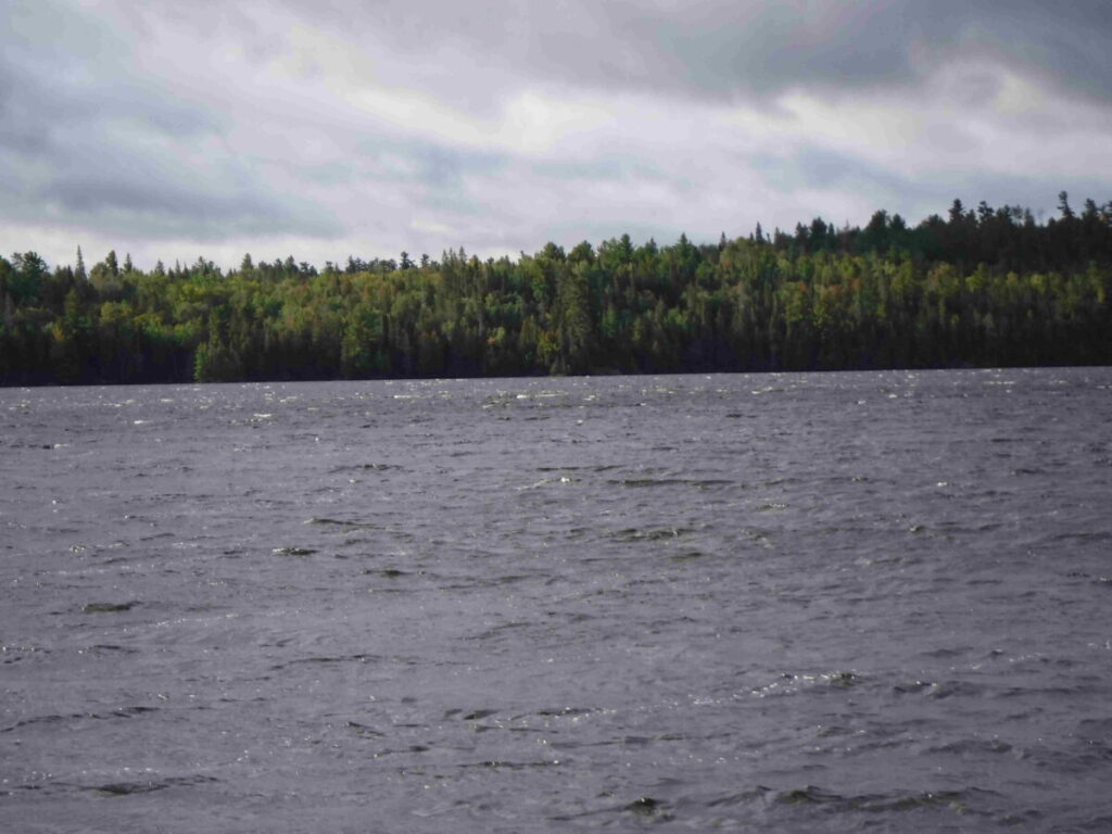
By 11 am the next morning I have made the trip back to the car and am paddling east along the lake from about where I left off. The weather is good, overcast with a breeze at my back. I look behind me occasionally to see if any change is moving in from the west. At about 1 pm I see the clouds darkening behind me and a sprinkle of rain begins. I start to paddle hard and think about what campsites lie ahead. Within a half hour the weather is deteriorating quickly, the wind picking up and the rain beginning in earnest. I decide to make it to a campsite on a small island up and across to the north side of the lake, using my GPS to set direction. I’m on the south side of the lake and will cross on a diagonal to get there.
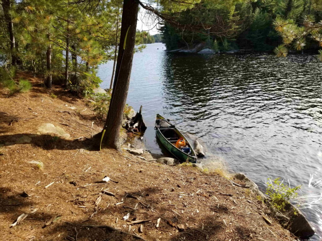
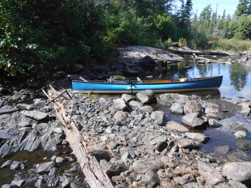
The wind and waves are up as I approach my target. The island is small, room for a one tent camp and that’s all, although it doesn’t look like anyone has ever camped there. I paddle to the leeward side to check it out. There doesn’t seem to be any landing spot. I check out the location again on my GPS – yep this is it. I circle the island and decide there is only one possible put in, on the lee side fortunately. Stepping out of the canoe I can see that this was once a good landing, but the bushes have overgrown the bank hiding its access, evidence that the site has not been used in a long time. The weather is getting worse, so this is where I am staying no matter what.
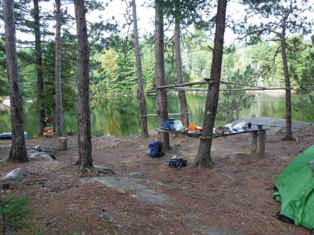
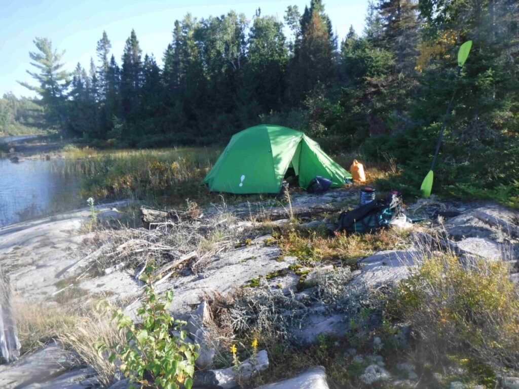
I carry up my canoe pack and other gear, then the canoe because there is no space to lay it safely except up near the campsite. I’m on an island about 25 meters x 10 meters, scrawny trees at both ends and along the north side, the south side exposed to the lake which is now rough and white capped. There is room for one tent, a table made between two trees and a short distance into some bushes a toilet seat indicating a thunder box . In all it’s good enough and a I start setting up camp knowing the bad weather will stay today and hopefully improve tomorrow. I put the hammock under the tarp so I will have a place to relax out of the rain besides using the tent – it’s going to be a wait. I expect strong winds and attach extra tie downs to the tent. I don’t think they are really necessary because the tent has been stable in winds before, but if I set them up anyway so I will have a sounder sleep free of worry.
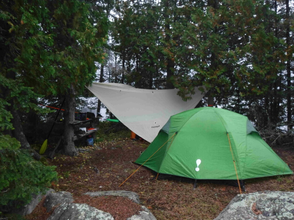
I wander around my little domain. There is a rough made table tumbled over and the remains of a fishing rod. A small tree has been cut down but not cut up. There are mounds of earth that turn out to be the construction detritus of subterranean ant colonies, luckily not the biting kind. I rename my spot Black Ant Island . Except for me, they have this place all to themselves. I lift the toilet seat of the thunder box to check and find the ants have completely filled whatever was there. The island is a bit desolate and the strong winds are now up, the driving rain and grey skies reinforcing the bleak feeling. Relief comes from reading a good book, stretched out in the hammock, sipping occasionally from a cup of wine nearby on the ground.
Later I make dinner, eat and get ready to settle in for the night, checking the latest weather report on the InReach – wind and rain forecast for all day tomorrow, clearing in the evening. Getting to Mackenzie Lake is going to be delayed and I wonder if I will make it there at all. As I fall asleep I hear the wind getting stronger brushing against the tent, but sleep soundly knowing that it is secured.
Day Three, September 14th
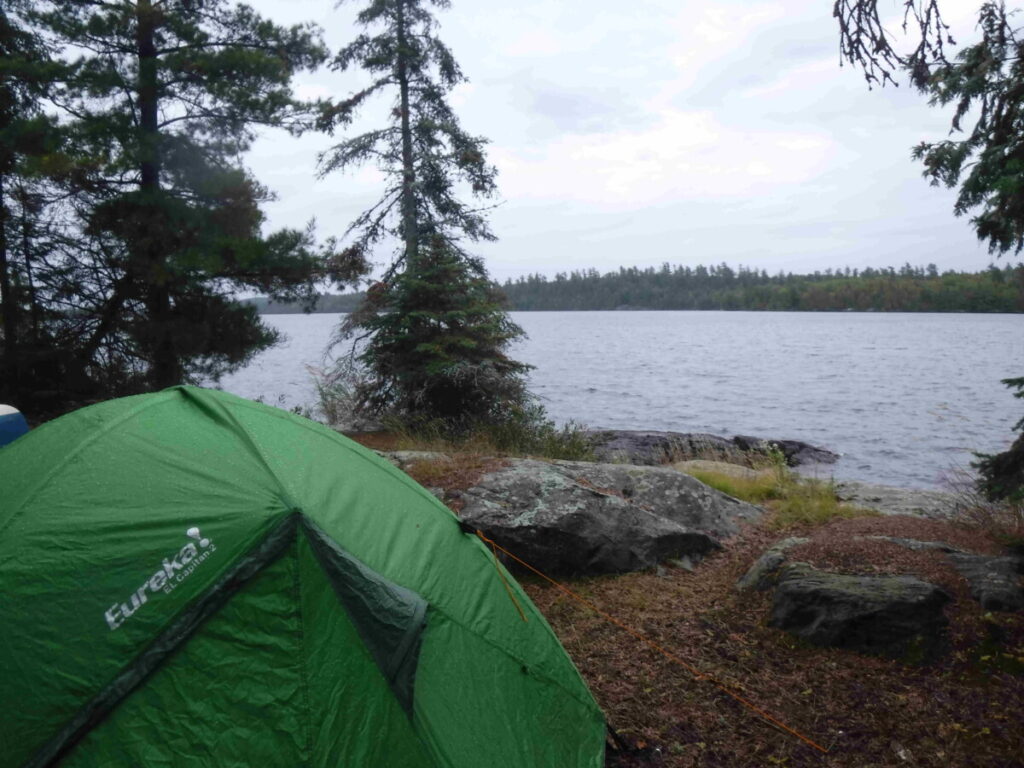
I crawl outside the tent after sleeping in, stand in light rain looking over the rough white capped water, knowing I will not risk traveling on this lake today reputed for sometimes becoming dangerously rough.
After breakfast, the day passes slowly, often standing to look out at the waves and sky hoping to see some sign of clearing weather. In the afternoon two small fishing motor boats appear, one person in each dressed in a bright coloured rain slicker. I guess they had set the day aside and were determined to catch something. After an hour they turned on their outboard motors and sped away down the lake toward the launch site I came from two days ago. No one else appears after that.
I made myself bust clearing the brush from the landing on the island to make it more apparent and easier to access coming and going. The rest of the day I spent napping and reading, returning to the water edge now and then to gaze up and down the lake, later making lunch and eventually dinner.
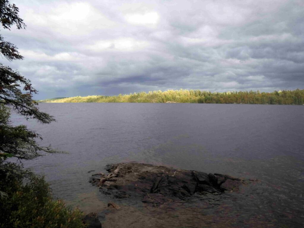
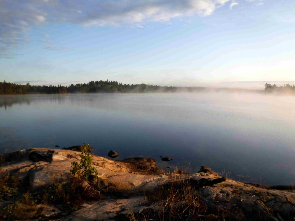
Late afternoon the first sign of clearing comes as the sun peeks through and the wind dies down. I go to bed that night hoping that it will be a better day tomorrow. Otherwise I will have to decide if I should cut the trip short.
Day Four, September 15th
I wake late and get up to look at the lake. It is calm and the sky is clear, meaning it’s time to hustle – make breakfast and strike the camp. I am going to head for Lake McKenzie even if I can only stay there one night, happy again to be heading toward my original target. There won’t be time to explore as I planned once I get there but it feels good to be on the move again. I am loaded and ready to go about 11 am.
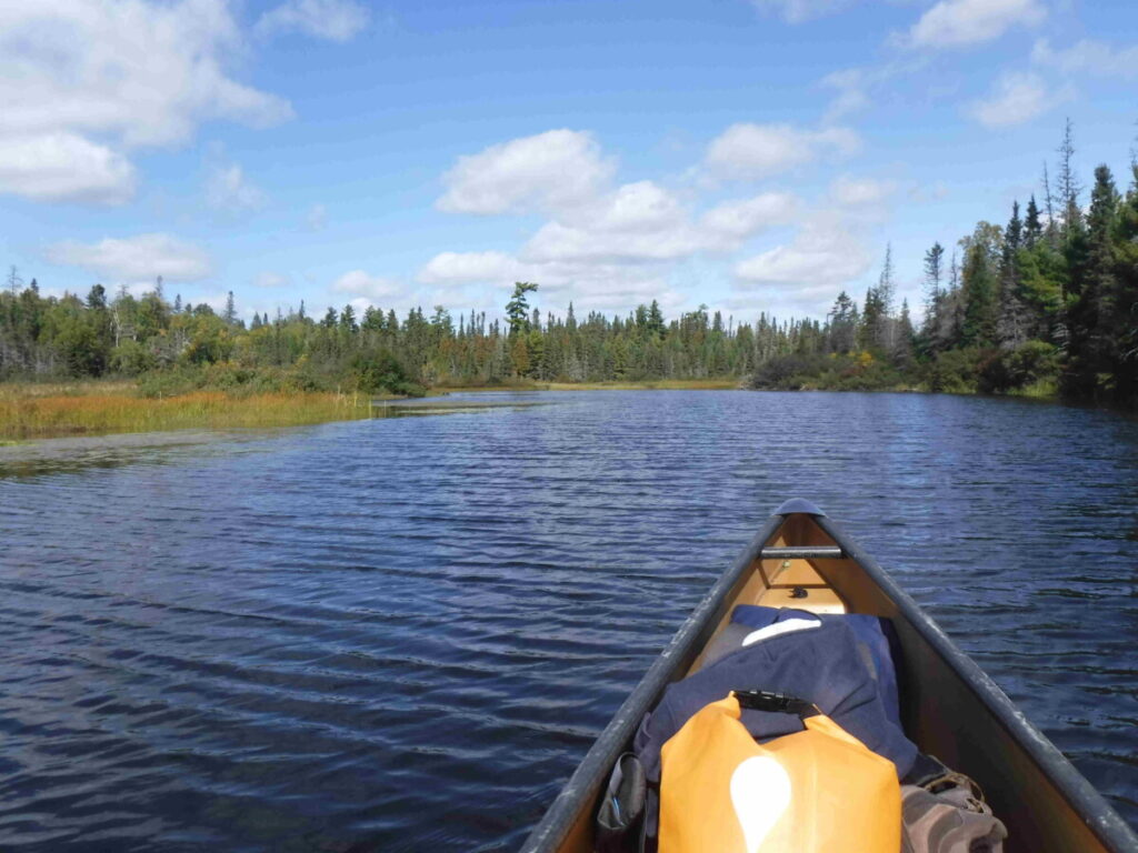
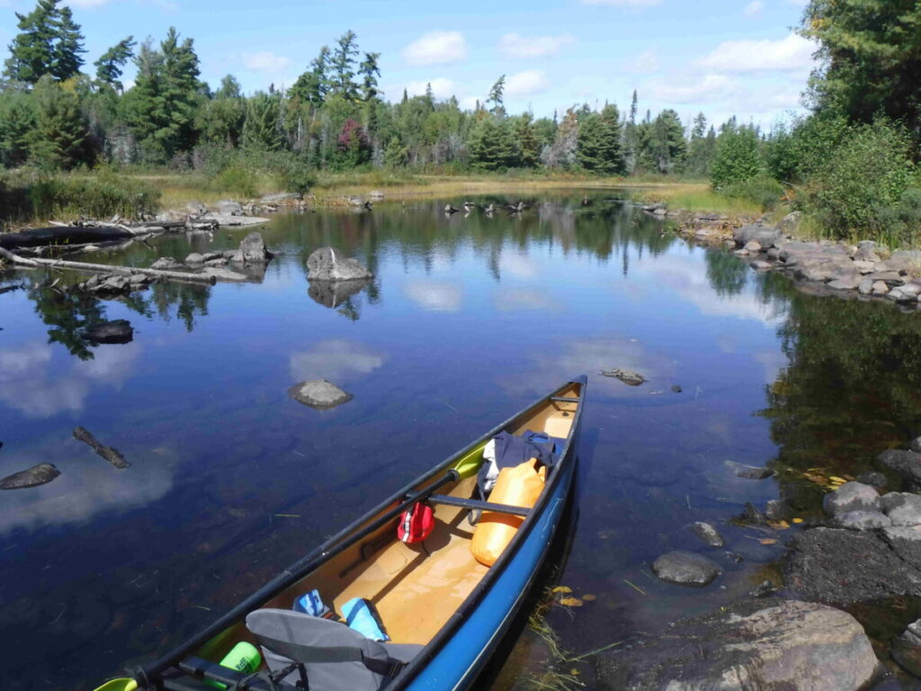
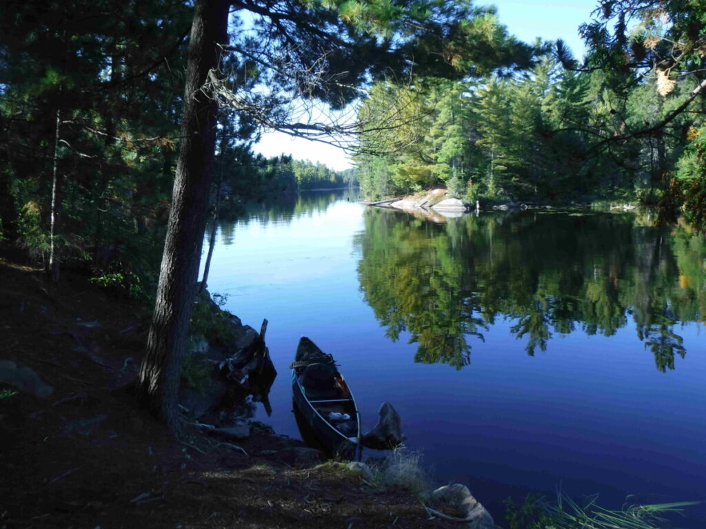
The conditions are perfect as if nature is trying to make up for yesterday. I am heading to the Eastern end of Wicksteed Lake , where I will take a river to Mackenzie Creek and on to Mackenzie Lake, the whole trip being about 15 kilometers.
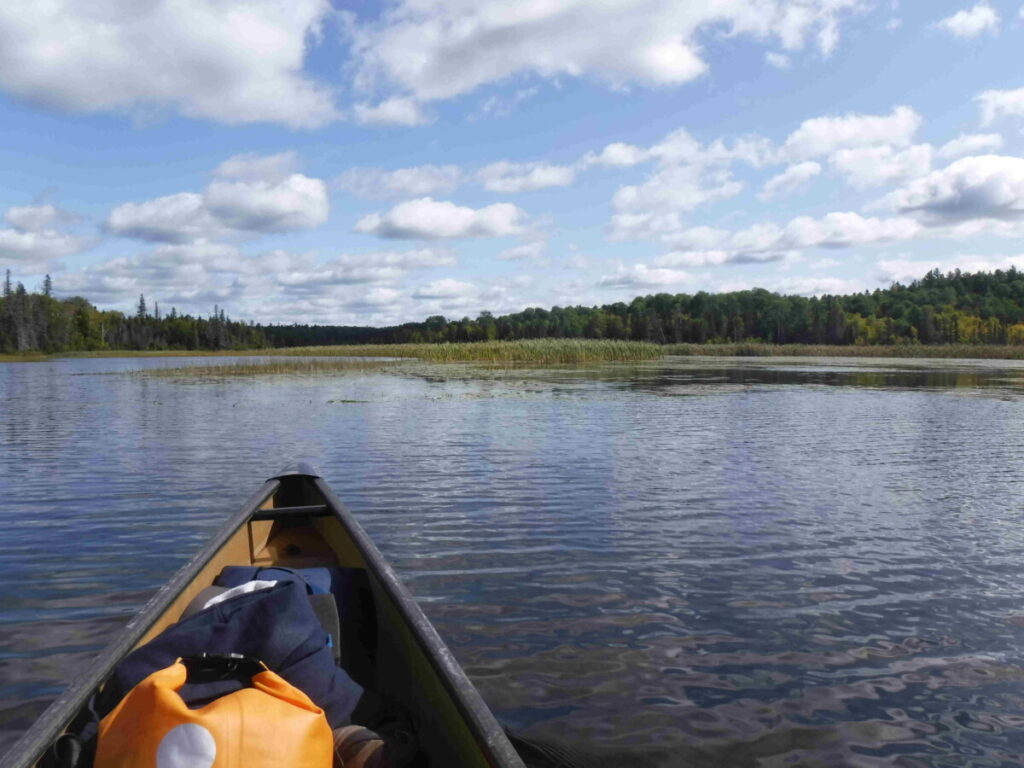
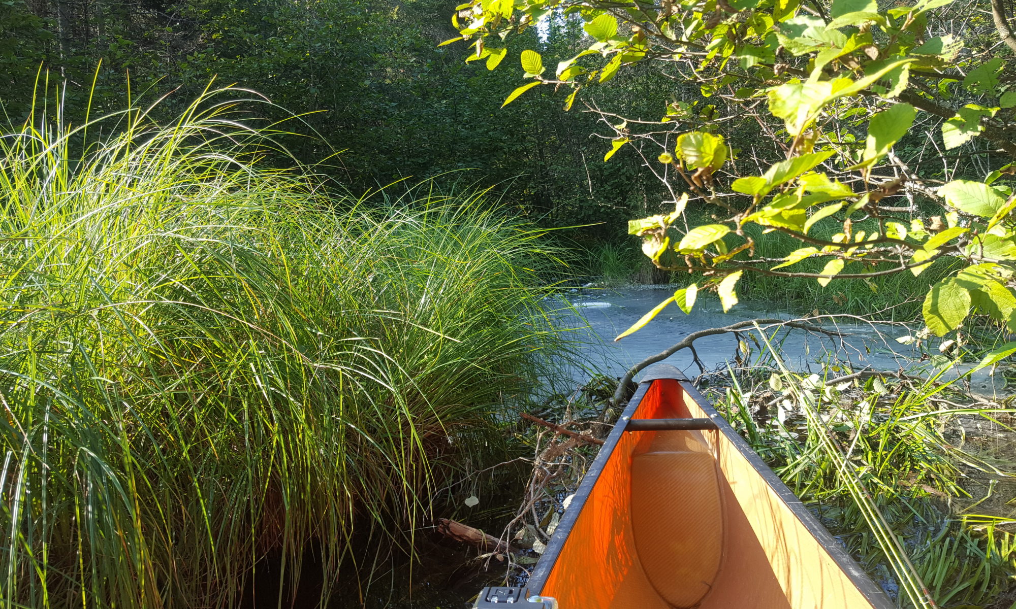
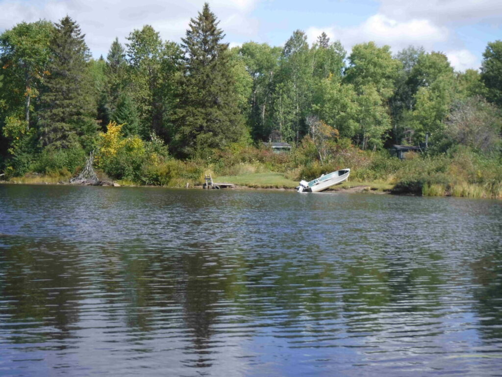
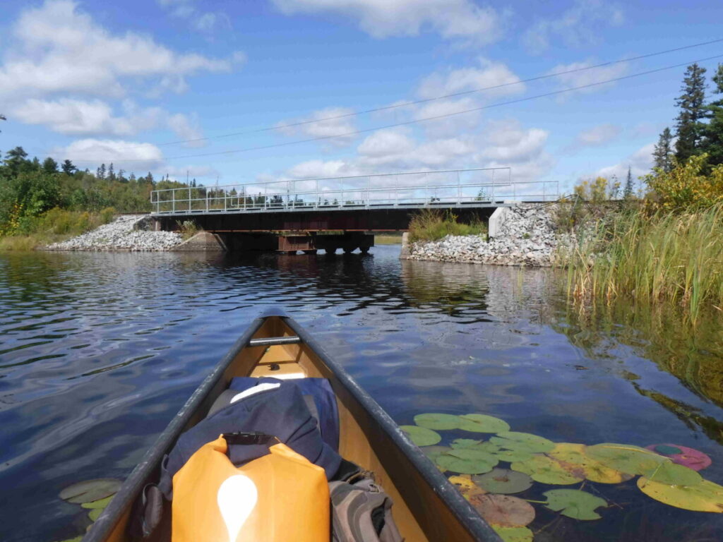
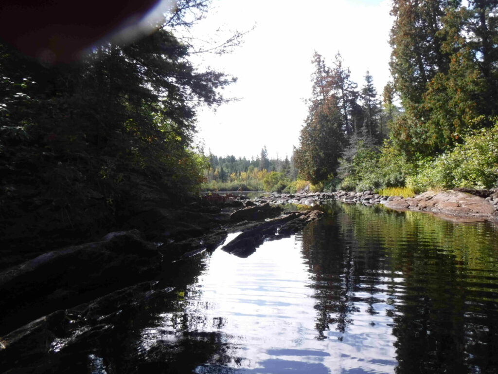
I reach the end of the lake about 12:30 pm and enter the river. It is easy to navigate with the usual channel twists among tall grass. I pass a fishing camp, with no one home and a boat pulled up onto the shore. Shortly after that I see the railroad tracks I had noted on the map running parallel to the river . The telegraph poles beside the track lean askew and the lines are mostly gone. I wonder if the track is used, but can’t see enough of the rails to find out.
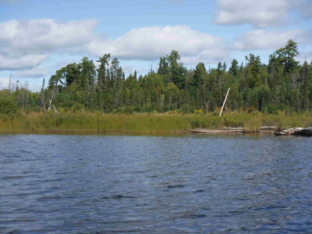
A railroad bridge appears that goes over the entrance to Mackenzie Creek. I wonder about barriers on this part of the trip that are not on the map as I head under the bridge into the creek.
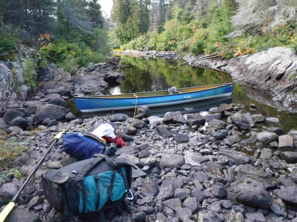
The creek starts out wide and easy to paddle. Further on it narrows and I come to the first spot to carry over. Looking closely however I see a way to pull the canoe through a narrow bending channel. Out I get and easily but carefully pull the canoe through.
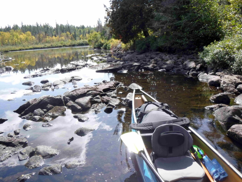
Back in the canoe and paddling around a bend I see rocks across the creek with no way to get past except carrying canoe and gear. I am puzzled why there is some pipe there and what it might have been part of before finding its way here.
This when an ultra light canoe makes carrying easy. My canoe pack weighs far more than the canoe. I walk slowly and carefully, making sure I have a good footing each step on the strewn rocks. It doesn’t take long to be loaded and ready to go again.
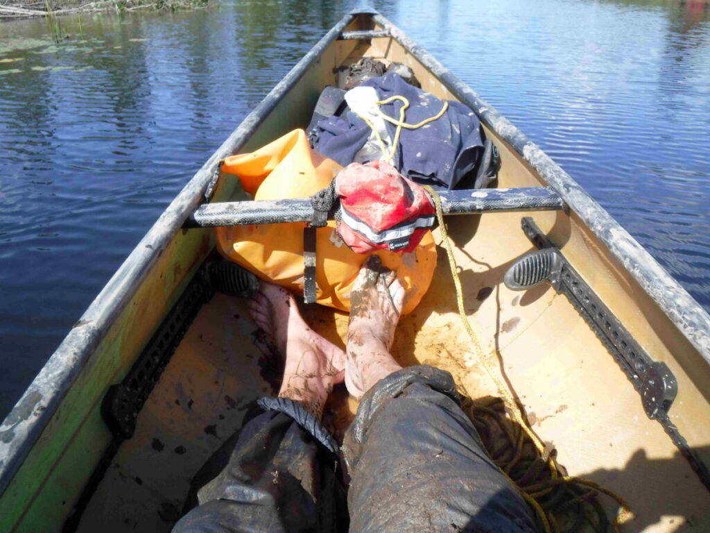
Confident that this has been the worst barrier except perhaps for some beaver dams I paddle on, taking in the landscape and the sunshine. The creek is wide and clear ahead. Suddenly I stop abruptly on a mud bar, that I hadn’t noticed gazing around.. No problem I think : I’ll just paddle off of it with two or three strong strokes. I’ve done this before. The canoe moves a few inches and then no more. Instead of sensibly backing up I try harder, ensuring that I’m stuck tighter in the mud. It’s then that I look into the water and realize there is mud across the whole creek and about 20 feet ahead. I had not noticed it partly because of my inattention and partly because the mud was just below the surface, covered with grass that lay on the water hiding it, well not enough that I wouldn’t see it if I was actually looking.
I use my kayak paddle as a pole to push ahead – nothing. Then I decide if I put one foot into the mud out of the canoe it might lift enough to glide over the mud while I pushed. So I put my left leg over into the mud, hold the gunwales, with my right knee still in the canoe, and push – nothing. Now I realize that my foot is stuck in the mud up to my knee. I can’t get my leg out because my water shoes are acting like an anchor. Now I begin to think that this could turn out badly. I wiggle my foot in the mud, prepared to lose the water shoe if I must. Finally I get free, the shoe still on and return to sitting in the canoe. It really is time to sit and think.
The only way out of this is to pull the canoe across the mud from the shore. I need to get to shore, about 20 feet away, with a rope. Then with the canoe being lighter I should be able to pull it ahead from the creek bank. I empty my pockets and tie the emergency rope I always have in the canoe to its forward thwart, ensure that my InReach is securely clipped to my PFD and then go over the side into the water and mud. I float on my back which along with the rest of me is scraping across the mud. There is enough water to prevent me from sinking into the mud and paddling backwards with my arms, pushing with my kegs I make it to the creek bank in a couple of minutes. I turn over to stand up and discover that my foot is going to into the bank as deep as it did in the mud, so I crawl until I am on squishy but not sinking ground. I get set and pull on the rope to the canoe. It takes a lot more effort than I expected but it starts to move toward me. I keep pulling while I walk along the bank to where I see the mud ending and clear water, standing there and pulling again and again until I finally have my canoe back. The worst of the ordeal is over.
I wish I had taken pictures of all this, but I left the camera in the canoe when I floated to shore. When I am back in the canoe and ready to continue, I take one shot of the evidence of the mud, showing hardly enough of the mud which is all over the canoe, stem to stern, inside and outside, and all over me. My water shoes are off , but saved for another day.
Determined to make Lake Mackenzie, it never occurred to me to pull the canoe back and return to Wicksteed. One just doesn’t do that kind of thing. Now I am soaked, muddy, smiling and off paddling again. When I return tomorrow I will get out of the canoe before the mud and pull it through.
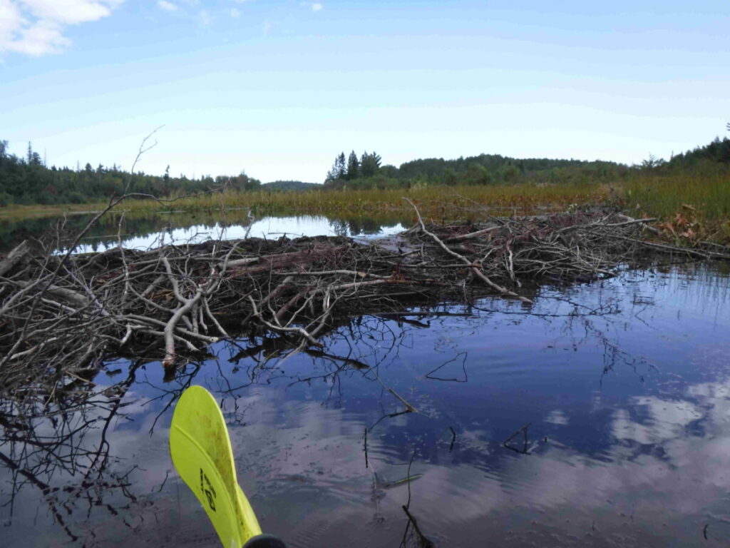
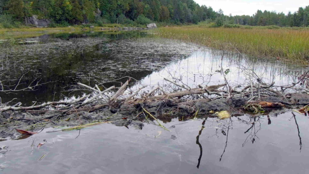
The next challenge is a beaver dam, nothing about it I haven’t done before and I pull the canoe over easily. Anything but more mud is OK.
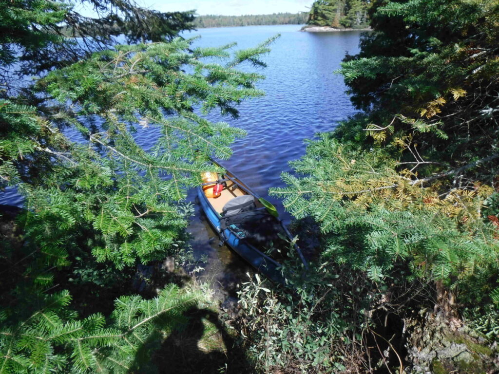
Planning this trip, I referred to a few maps that included Mackenzie Lake: two had campsites marked on the lake while the others showed nothing. I marked the locations of the supposed campsites in my InReach map, wondering what I would find. Paddling into the lake I searched for the first campsite closest to where I was. Even though the GPS showed me right next to it, I saw nothing at all to indicate any thing that might be a campsite. I am certain of my coordinates , concluding that the site has been long grown over. I paddle on to the next location and see no signs of a campsite there either in the dense brush on the shore.. The third attempt should be obvious because it is supposed to be on a point , which I see in the distance. Paddling up to it I can see how it could be a campsite but there are no signs of it being used, like a fire-pit or some cut branches. It’s just an exposed rocky point with a poor spot to put in. Off I go searching for another that is supposed to be on a small island, according to a trip report I read on the web posted several years ago. The island is almost barren, a possible campsite there only using a great imagination.
Now I am tired of looking and decide to go back to the point site. I find a spot to safely put the canoe into and carry my gear up the rock face to the top flat surface. All at once I realize that I am wet and tired, and begin to shiver. I put the tent up quickly, and leaving everything else for later, fling my air mattress and sleeping bag inside. As fast as I can I get the mattress inflated, strip and crawl inside the sleeping bag to get warm. It’s about 4 pm and I fall asleep for an hour. Waking I put on dry clothes and set up the rest of the camp, just the cooking area, there being no way to string the hammock. After making dinner, eating and cleaning up I stow the bear vaults with my food away from the camp back from the tent toward the shoreline woods, not as far away as I would like but it will have to do. Back in my sleeping bag I read and fall soundly asleep. It’s been an eventful day.
Day Five, September 16th
I am up at sunrise to see another beautiful day. I regret having no time to explore the lake and the creeks leading out of it as I had planned, but am pleased I made it here despite the setbacks. The sound of a train engine tells me the railroad tracks where I came from are being used. I will be heading back after breakfast, attempting to get all the way to my first night’s campsite, because it will be close to where I put in, making it possible to get to where I started, the load the car and head home at a reasonable hour tomorrow.
it’s 9:30am. I’ve had a leisurely breakfast, packed up and am ready to go. Yesterday’s mud marks the sides and inside of the canoe. I will clean it later. Now it’s time to begin a long day’s paddle with the beaver dam, mud and rocks ahead, confident that there will be no problems getting past them.
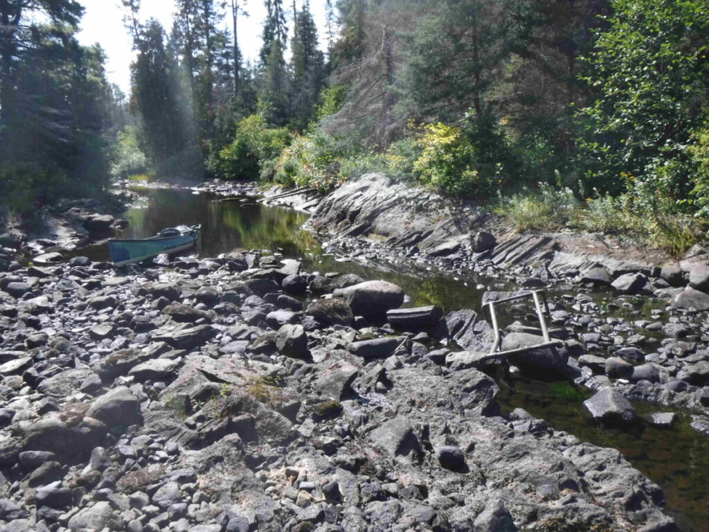
First up is the beaver dam, which I pull the canoe over easily and paddle on to, yes, the mud! This time, knowing what I am in for, I take the canoe to the creek bank before the mud begins, take off my water shoes, grab the line attached to the canoe and go ashore, sinking immediately to my calves in the soft squishy ground. Without water shoes to catch me in the mud I can pull my legs up easily and take steps to firmer ground,which is to say I sink maybe to my ankles. I’m ready, play out the full length of the rope to pull the canoe as parallel to the bank as possible and then I pull hard. It works well. The canoe comes across the mud to a spot I choose to get back in. The worst part of the day’s trip is over and it wasn’t that hard when I did it the right way even though it took some strength to move the canoe.
I come to the rock bed across the creek. I know this is more inconvenient that hard to get past. I unload and carry the canoe across, anchoring it to a rock because the current wants to take it away downstream. Next is the spot where I have to pull the canoe for a bit, easy, easy easy.
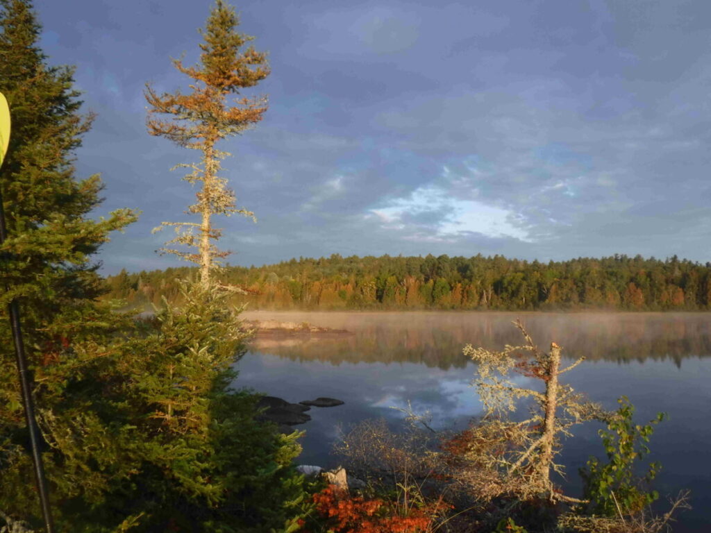
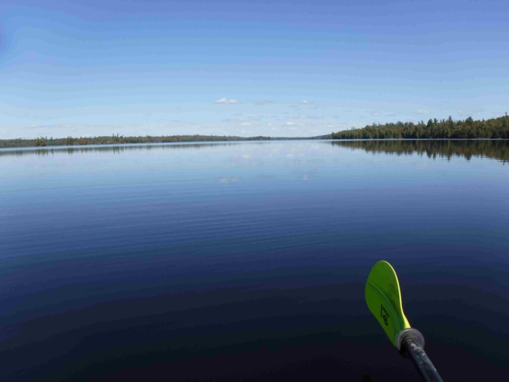
Now it’s steady paddling for most of the day to get to my campsite. It is warm, calm and the sky is clear. I start de-layering to enjoy the warmth and settle into a rhythm. About 1 pm I am well into Wicksteed lake heading west. The sky folds into the lake like the edge of a still water infinity pool. There is no other sound than my paddle and the canoe’s ripples. I am alone.
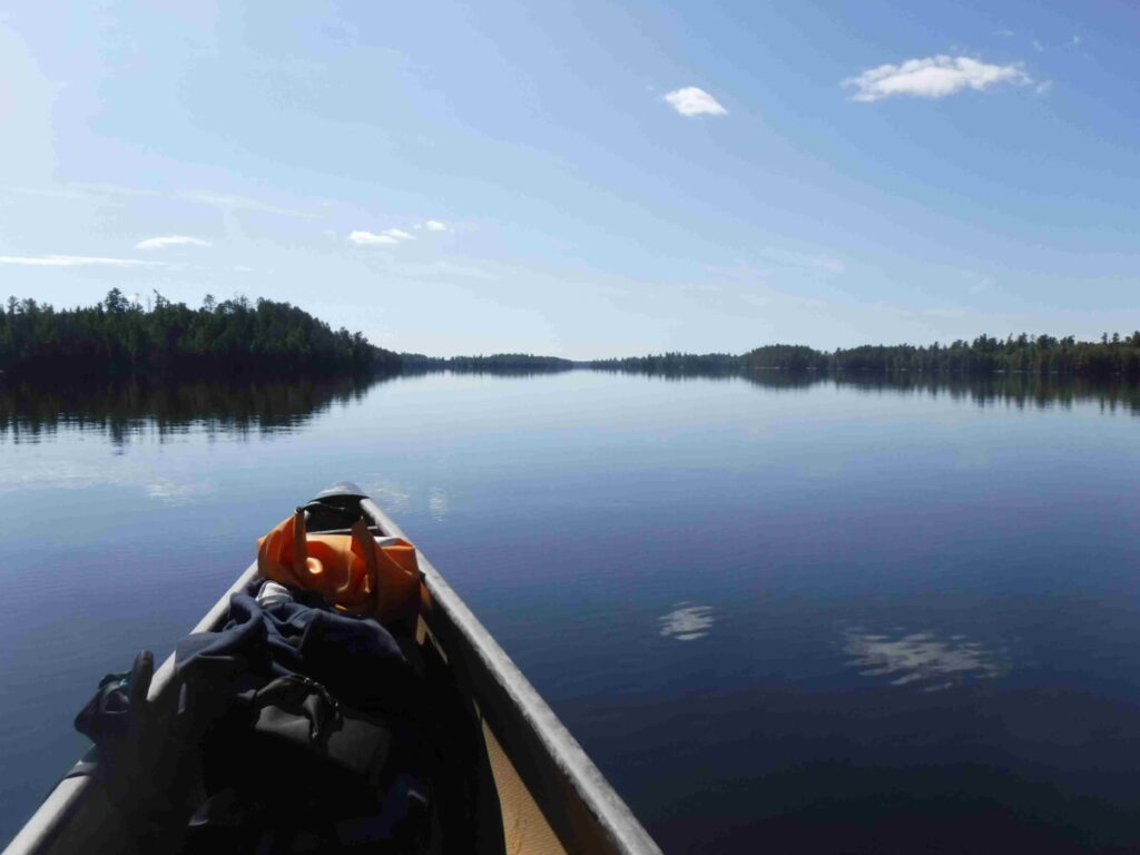
Later I look back and see how far I have come. It’s a long way.
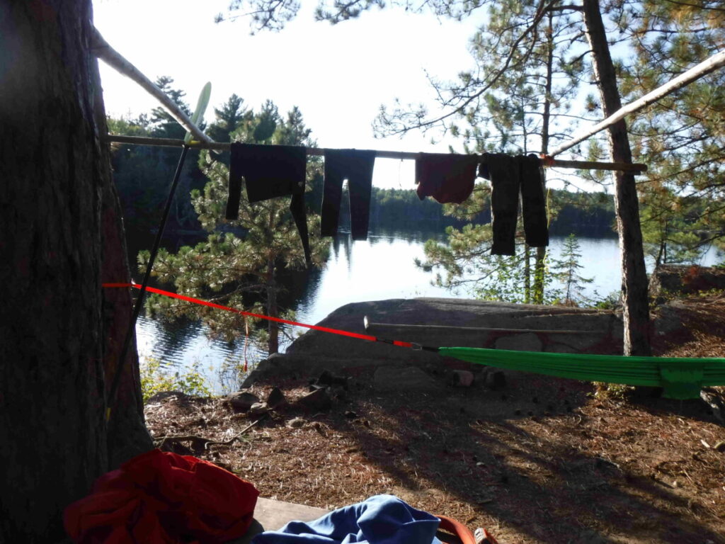
It’s about 3 pm and 18.4 kilometers of paddling when I reach my campsite. I have looked at some other possible sites along the way but none seemed to be as good as this one. I set up camp, hang up my wet muddy clothes in the sun which I’ve packed in a separate bag, and make a late lunch. After that I relax in the hammock and read. Later have a good dunk in the lake to wash up and begin to get dinner ready.
Day Six, September 17th
It’s time to go home. The canoe is packed and ready for the 1 1/2 hour trip to where I started. It seems each canoe trip I take has its own story to tell, regardless of what I planned and this one has been no exception. Its my first venture into the Temagami Region and I will come back again, going further north onto Lake Temagami itself. I appreciate now the work that goes into maintaining campsites in Algonquin Park and the effort by its campers to leave no trace, the few exceptions being all the more startling rather than normal as it is outside the park. That said, we are blessed: Toronto is one of the great urban centres of the world and not too far away is a vast network of lakes and trails that speak to us and embrace us when we go there to ask.